Visit Us

Introduction to Taiwan

General Information
Population: 23.57 million
Area: 36,197.067 square kilometers
Peoples: Han Chinese (97%), Aborigines (2%), Other (1%) Languages: Mandarin / Taiwanese / Hakkanese / Aboriginal Foreign Languages: English, Japanese
Currency: New Taiwan Dollar (TWD/NT$)
Time Zone: National Standard Time (UTC+8)
Electricity: 110V, 60Hz


Geographic Environment
Geographic Location

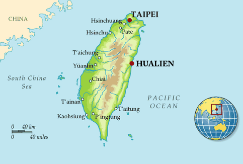
Taiwan is located between the southeastern coast of the Asian continent and the East Asian islands distributed along the western Pacific Rim. To the north lie Japan and the Ryukyu Islands; to the south are the Philippine Islands; to the west is Mainland China. Taiwan is a long, narrow island stretching from north to south. The island is about  395 km long and about 144 km wide, with a total land area of around 36,000 square kilometers (about 14,400 square miles).


Topography

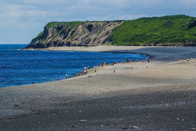
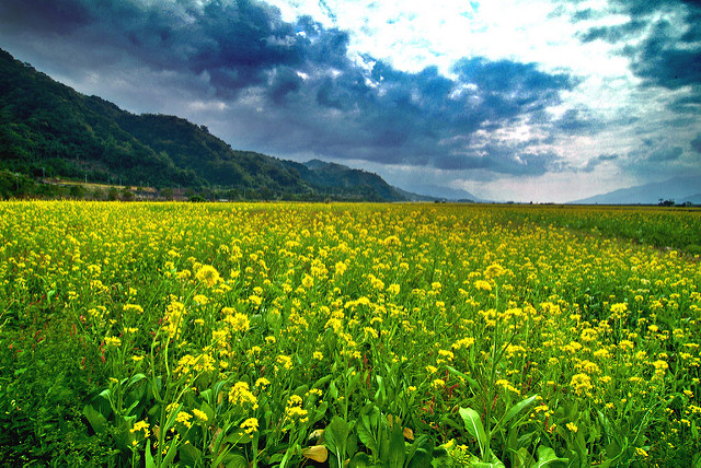
Taiwan is endowed with steep mountain ranges; therefore, great altitude differences occur throughout the island. The mountains mostly run from north to south. The highest point is Yushan Peak of the Yushan Mountain Range, which reaches an elevation of 3,952 meters above sea level, making it the highest peak in Northeast Asia. Since mountain areas cover a majority of the island, Taiwan’s ecological resources are abundant. The plains of Taiwan are relatively narrow and found only in the western region and the longitudinal valley along the east coast. These also happen to be the most densely populated areas in Taiwan.

Climate

  • Average annual rainfall in Taiwan is 2,515 mm. It is a tropical and subtropical climate zone with a high temperature and rainy climate. The average temperature for the northern half of the island is about 21.7°C; the average temperature for the southern half is around 24.1°C. The island is coldest from January through March with temperatures dropping to around 10°C. From June to August, hot weather prevails, with temperatures rising to 38°C. More moderate temperatures follow in the months between, with an average temperature of 25°C.
  • Online References: https://eng.taiwan.net.tw/

Introduction to Hualien

Hualien is eastern Taiwan’s second largest city and one of the more pleasant small localities in Taiwan. Many travelers like to base themselves here, even when Taroko Gorge is their interest, as the range of food and accommodations is greater. Budget travelers will find everything they need near the train station. Head east to Meilunshan Park (Měilúnshān Gōngyuán) and the harbor area for wide streets, landscaped parks, bike lanes and ocean views, in addition to boutique hotels and pricier restaurants.

Hualien means ‛eddies’ in Taiwanese and the story goes that Qing Dynasty (1644- 1912) immigrants gave the region this name after noticing swirling waters off the coast. Though much of the city’s wealth comes from tourism, local deposits of limestone have also made Hualien the cement capital of Taiwan.

Road signage in Hualien is a mixed bag. Don’t be surprised if “Jung Shan” is written as “Zhongshan,” “Jung Jeng” as “Zhongzheng,” and “Jung Hua” as “Zhonghua.”


You can go online and learn more about the beauty of Hualien, such as the English website https://bit.ly/2ERy24M

You can also go to the Chinese website https://bit.ly/2JZ9j2H


Hualien’s Climate

Hualien City is hot and humid in summer, and comfortable and windy in winter. During the year, the temperature ranges from 15°C to 32°C, and is rarely below 12°C or above 34°C.

The wardrobe you need

  • Spring (January to March): You may need sweaters, long sleeves and jackets.
  • Summer (April to June): Wear short sleeves and a light jackets.
  • Autumn (July to September): Prepare breathable and sweat-absorbent shorts.
  • Winter (September to December)-
    • September to October - It is recommended to wear short-sleeves and light jacket.
    • November: You may need light long sleeves and a light jacket.
    • December: You may put on sweater, long sleeves, jacket, or coat. If it is cold, you may need gloves, a wool cap and mask.

Scenic Places in Hualien

Taroko National Park

Taroko National Park is one of nine national parks in Taiwan, and is located in eastern Taiwan.

This national park is bordered by the Pacific Ocean in the east, with the Central Mountain Range passing through the park. The highest peak in the park is Nanhu Mountain, which has an elevation of 3,742 meters (12,277 feet). Seven point two percent of the park is covered by mountains over 3,000 meters (9,000 feet) in height; 27 mountains are among the top 100 peaks in Taiwan; 78.4% of the park’s area is mountainous, with altitudes ranging from 1,000 meters (3,000 feet) to 3,000 meters (9,000 feet). Moreover, nearly 44.7% of the park has a gradient over 55%.

The Liwu River cut its channels through layer after layer of rock, while the Central Mountain Range rose up, and as a result, magnificent gorges were formed. Taroko’s narrowed V-shaped marble gorges, with over 1,000 meter (3,000 feet) deep canyons, and more than 1,000 meter high mountains, stretch more than 10 kilometers.

Taroko Gorge Marathon

The Taroko Gorge Marathon is an annual event that has been held in November since 2000, and it has been sponsored by the Road Running Association. In 2015, a total of 12,000 runners participated in this event. Among them, 3,000 chose to run the official distance of 42.195 kilometres (26.219 miles); 6,000 competed for a half marathon with a distance of 21.0975 kilometers (13.109 miles); moreover, 3,000 selected the mini marathon, which has a distance of 5 kilometers (3.107 miles). Most participants were Taiwanese, yet 500 runners were from places other than Taiwan.

Malongayangay

Malongayangay used to be on the eastern side of Hualien Airport, and it was a big lake looking like the Big Dipper. The northern end was the Big Dipper’s bowl, and its southern end was the handle. Taiwan was under Japanese rule from 1895 to 1945, and in order to build an airport in 1936, the Japanese initiated a landfill project. As a result, a large lake was turned into four scattered ponds.

Residents living in Malongayangay were asked to move to Cikatingan by the Japanese. They missed Malongayangay, so they renamed Cikatingan Malongayangay. Today Malongayangay faces the Pacific Ocean, and its ground is covered by gravel. The deep ocean is nearby, plus the Kuroshio Current flows along its coast, which attracts many types of fish to migrate on a regular basis. Thus, Malongayangay used to be a booming fishing town, and people used fixed-nets to catch fish.

East Rift Valley National Scenic Area

The East Rift Valley National Scenic Area was founded 1997.

East Rift Valley is sorrounded by Central Mountains in the west and Coastal Mountains in the east. Hualien River, Xiugulan River and Beinan River, originating in mountains ranging from 2,000 to 3,000 meters (6,000 to 9,000 feet) in height, flow through this area. As a result, a flat landform was created by the deposition of sediment, carried by these rivers, over a long period of time.

Many towns in this area produce high quality rice, and when Taiwan was under Japanese rule, Chishang’s rice was presented to the Emperor of Japan every year. When not growing crops, some farmers grow rapeseed flowers and others plant orange daylilies. In January, rapeseed flowers blossom in Satokoay, Luyeh and Chishang, so these towns sponsor outdoor activities, enabling visitors to appreciate their beauty.

In April and May, many fireflies show up in Liyu Lake for mating. In July and August, harvest festivals are held by Amis tribes people in Hualien and Taitung Counties to celebrate their harvests. In August, the International Paragliding Competition takes place in Luyeh Township, Taitung County. In September, orange daylilies blossom beautifully on Chike Mountain in Yuli Township and on Liushidan Mountain in Fuli Township, with both places situated in Hualien County. In December, Puyuma tribes people in Taitung County celebrate their Hunting Ritual.

Liyu Lake

Liyu Lake is in Shoufeng Township, Hualien County, and it’s situated at the northern end of the East Rift Valley National Scenic Area. This lake is oval-shaped, with an area of 1,040,000 square meters (256 acres). The lake’s deepest spot is 15 meters underwater, with its water coming from an underground spring. Consequently, the lake is clean year round.

The lake is beautiful and both its environment and water quality are well maintained. In recent years, Liyu Lake has been the site of the Firefly Festival, sponsored in April and May every year, to familiarize visitors with the lives of fireflies, and share efforts in environmental protection and nature conservation.

Lintianshan Forestry Culture Park

Lintianshan Forestry Culture Park was formerly the Lintianshan Forest Area and used to be the fourth largest forest area in Taiwan.

Lintianshan Forestry Culture Park maintains much of its Japanese Occupation history, reflected through former offices and residences, living facilities, staff dormitories, logging and transportation machines and tools, rail tracks, an old elementary school and a church.

Liushidan Mountain

Farmers of Liushidan Mountain grow their orange daylilies organically. Orange daylilies bloom from July through September, and this is the best time to pay a visit for appreciating their beauty. While orange daylilies are everywhere, they are like carpets with orange-yellow colors, and grow among on the green grasses, in the woodlands, on house rooftops, or in gardens.

East Coast National Scenic Area

The East Coast National Scenic Area was established in 1987 and, suprisingly, Green Island has been a part of it since 1990. This area stretches from the mouth of Hualien River in the north to Xiaoyelio in the south.

This area is bounded by the Pacific Ocean in the east and the Coastal Mountains in the west. It is situated in the region of active deformation, from the coast of Hualien County to the mouth of the Puyuma River in Taitung County, where earthquakes take place very often. Shale that has been pushed upward is still being pushed upward by tectonic action, and plate collisions, along with marine erosion, has produced a wide range of landforms here, including coastal terraces, sea-eroded platforms, trenches and caves.

Farglory Ocean Park

Farglory Ocean Park is also named Hualien Ocean Park. Situated in Hualien County, Hualien Ocean Park is only 10 kilometers from Hualien City, and it is about a 30 minute drive away. The park covers 510,000 square meters (126 acres), is Hualien's biggest man-made tourist attraction, and Taiwan’s first theme park focusing on marine ecology. Hualien Ocean Park features eight zones that introduce different aspects of ocean and marine life. From thrilling water rides, bumper boats, dolphin shows to roller coasters, everyone can have fun in this amusement park. Moreover, visitors will be astonished by the dolphin’s and seal’s amazing acrobatic abilities in the aquatic shows.

Niushan Huting

“Niushan Huting” translates to Cow Mountain, which is a rather odd name for a beach, one would think. Yet, long ago, before this area was on the map, the rolling green hills surrounding the small bay were a place for Amis tribes people to graze their cows and other livestock. Taiwanese lilies originate in this area, and they blossom everywhere in spring. Niushan Huting has a bountiful variety of plant species, so it has been designated a nature reserve since 1987.

Martin Scorsese filmed scenes here in 2016 for his Hollywood film Silence

Silence is a 2016 historical period drama film directed by Martin Scorsese, with a screenplay by Jay Cocks and Scorsese, and based on the 1966 novel of the same name by Shūsaku Endō. The film stars Andrew Garfield, Adam Driver, Liam Neeson, Yosuke Kubozuka, Tadanobu Asano, and Ciarán Hinds.

Tungtamen Night Market

The largest night market in Hualien, Tungtamen Night Market is a part of the 6th re-zoning area, located near the downtown area, and specifically, it is to the west of Zhongshan Road and south of Chongqing Road.

The three main market lanes are Futing Market (Taiwanese food), Indigenous Street (indigenous food), and a street serving foods from all the provinces of mainland China, and these lanes accommodate more than 400 shops. Visitors may try all kinds of food here.

In 2015, the Hualien Ziqiang Night Market moved from its old location, and is now located in the 4th market zone. You can go shopping here and taste delicious foods from many popular stores that used to be in Ziqiang Night Market.

Malalikit (Ami’s Harvest Festival)

The Harvest Festival is a festival celebrated by the Amis tribes people. With a population of 170,000, the Amis is the largest indigenous group in Hualien. Other than celebrating the harvest, the “Harvest Festival” is also associated with elements of politics, the military, economics, education and training, and thus it is the most important annual event for the Amis.

Right after harvesting millets, Amis tribes people wanted to express their gratitude for what they have gathered, and so they initiated this celebration, which is the origin of the “Harvest Festival.” The “Harvest Festival” is held at different times, and normally, Amis in the Taitung area celebrate in July on the lunar calendar; the one in Hualien area is celebrated in August on the lunar calendar.

During the ceremony, singing and dancing play key roles. When dancing is going on, males are the major performers, and they only dance with other males; females dance with other females. Singing always accompanies dancing, and only group dancing is permitted, so individuals must join groups to understanding the meaning and spirit of their singing and dancing. Although participants enjoy singing and dancing in the festival, they are taboo in daily life. When singing and dancing take place throughout the whole ceremony, the ceremony is carried out in stages: preparation, welcoming the spirit, feasting spirit and seeing off the spirit.